


Beaulieu Twp. Voting District, Mahnomen County, Minnesota
About
Outline

Summary
| Unique Area Identifier | 603012 |
| Name | Beaulieu Twp. Voting District |
| County | Mahnomen County |
| State | Minnesota |
| Area (square miles) | 35.63 |
| Land Area (square miles) | 33.70 |
| Water Area (square miles) | 1.93 |
| % of Land Area | 94.58 |
| % of Water Area | 5.42 |
| Latitude of the Internal Point | 47.37096480 |
| Longtitude of the Internal Point | -95.73235810 |
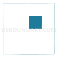
Maps


Graphs
Select a template below for downloading or customizing gragh for Beaulieu Twp. Voting District, Mahnomen County, Minnesota


Neighbors
Neighoring Voting District (by Name) Neighboring Voting District on the Map
- Chief Twp. Voting District, Mahnomen County, MN
- Clover Twp. Voting District, Mahnomen County, MN
- Gregory Twp. Voting District, Mahnomen County, MN
- Heier Twp. Voting District, Mahnomen County, MN
- Island Lake Twp. Voting District, Mahnomen County, MN
- La Garde Twp. Voting District, Mahnomen County, MN
- Rosedale Twp. Voting District, Mahnomen County, MN
- Twin Lakes Twp. Voting District, Mahnomen County, MN
Top 10 Neighboring County Subdivision (by Population) Neighboring County Subdivision on the Map
- Twin Lakes township, Mahnomen County, MN (818)
- Island Lake township, Mahnomen County, MN (233)
- La Garde township, Mahnomen County, MN (162)
- Heier township, Mahnomen County, MN (143)
- Rosedale township, Mahnomen County, MN (135)
- Clover township, Mahnomen County, MN (121)
- Beaulieu township, Mahnomen County, MN (108)
- Chief township, Mahnomen County, MN (96)
- Gregory township, Mahnomen County, MN (74)